


generalcanada
Senior Member
I feel safer on king than I do on front.
I know if i stay right of that white line Im good.
I know if i stay right of that white line Im good.
|
|
|
View attachment 650219
View attachment 650220
This was posted on Twitter by Toronto Cycling and Pedestrian Project Unit. I believe these are pretty new.
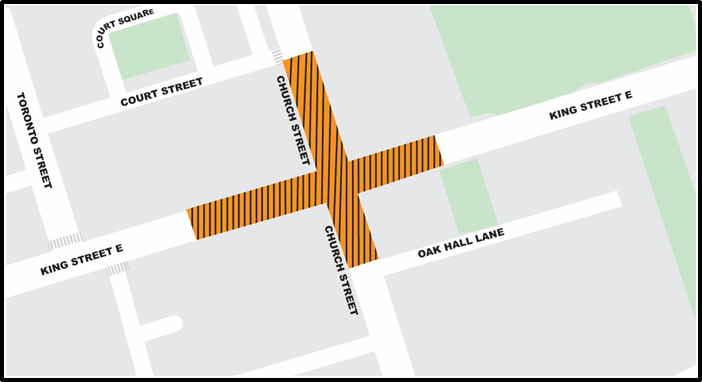
The only part of King 'downtown' getting new watermains in 2025 is the King/Church intersection. The plan is to replace more of it after FIFA ( the King/York intersection and Bathurst to Spadina in 2026). Not sure about Spadina to Church but Church to Sumach planned for 2027 or 2028 I was told) so I suspect that any permanent bump-outs are at least 4 years away.Weren't they supposed to have redesigned King to include permanent bump outs during the 2025-2026 King Street watermain and track replacement which has started now? Why are they still using temporary infrastructure as if it were a pilot? What has it been — 10 years?
The only part of King 'downtown' getting new watermains in 2025 is the King/Church intersection. The plan is to replace more of it after FIFA ( the King/York intersection and Bathurst to Spadina in 2026). Not sure about Spadina to Church but Church to Sumach planned for 2027 or 2028 I was told) so I suspect that any permanent bump-outs are at least 4 years away.

The only part of King 'downtown' getting new watermains in 2025 is the King/Church intersection. The plan is to replace more of it after FIFA ( the King/York intersection and Bathurst to Spadina in 2026). Not sure about Spadina to Church but Church to Sumach planned for 2027 or 2028 I was told) so I suspect that any permanent bump-outs are at least 4 years away.
 .
. I've always found it weird how streetcars have been deployed in Toronto, in the center of the road. I guess it was done this way because of car parking? I've always thought streetcars should be against the sidewalk on each side of the street or both sets of tracks be on one side of the street with bike lanes and cars on the other side. Either of these options would solve bike lane issues, accessibility into and out of the streetcar, and keep everybody out of each other's way. It would also save much needed time by not needing to use, or even need, accessibility ramps being deployed if the sidewalk gradually slopes up to streetcar door level around the stops.
They actually finished installing most of the new watermain on King to the east of Church but discovered 'underground conflicts' they were not aware of so are now removing all the streetcar track. I am not sure if this intersection was rebuilt 20+ years ago with the two 'foundation layers' around the tracks . If it was the work to replace only top layer is quite fast, if it needs the now standard two layers it takes a bit longer but the City are now planning to do BOTH watermain and track work together and to finish ALL of the work by mid-August (about 2 weeks sooner than originally). SEE: https://www.toronto.ca/community-pe...reet-church-street-intersection-construction/ Your photo shows they have already broken up the top layer of concrete in preparation for removing it.As of today, I dunno how much progress has been made on the watermain other than the crews, seemingly, taking out their aggression on the road surrounding the streetcar tracks
The current state of the King/Church intersection leaves me wondering how long the street car will be out of commission here. Like, what the...
View attachment 657265
Streetcars have existed in the centre of the roads around the world from day one including Toronto and long before a car existed. Cherry St and most of Queens Quay West are a few places around the world on the side of the road and not the centre. Washington DC tracks are where you find bike lanes, but they will disappear around 2027 when the existing streetcars are scrap and replace by a tram bus as the streetcar goes from no where to no where and only sees 800,000 free riders a year.As of today, I dunno how much progress has been made on the watermain other than the crews, seemingly, taking out their aggression on the road surrounding the streetcar tracks
The current state of the King/Church intersection leaves me wondering how long the street car will be out of commission here. Like, what the...
View attachment 657265
I'm also not a fan at all of the temporary raised platforms for bike lanes, even for small stretches. It feels really awkward biking over them and the wear and tear on the platform over time doesn't help, especially with winter weather.
I've always found it weird how streetcars have been deployed in Toronto, in the center of the road. I guess it was done this way because of car parking? I've always thought streetcars should be against the sidewalk on each side of the street or both sets of tracks be on one side of the street with bike lanes and cars on the other side. Either of these options would solve bike lane issues, accessibility into and out of the streetcar, and keep everybody out of each other's way. It would also save much needed time by not needing to use, or even need, accessibility ramps being deployed if the sidewalk gradually slopes up to streetcar door level around the stops.
Ah well. It would cost way too much to change it now.
I also get lots of ideas for transit from youtube channels like "Not Just Bikes" and "City Beautiful". I love when they cover transit solutions for various cities around the world. They often cover the problems a place was faced with and how/why they did what they did, not to mention what came of it. I sometimes get those light-bulb moments where I think "Hey, I think that would work here."
Unfortunately, you get the feeling that too many of the people making decisions here have either never been somewhere else, never looked at best practices in other cities, or decided "Toronto is unique; we need to reinvent things for our distinct city". It's very frustrating.I also get lots of ideas for transit from youtube channels like "Not Just Bikes" and "City Beautiful". I love when they cover transit solutions for various cities around the world. They often cover the problems a place was faced with and how/why they did what they did, not to mention what came of it. I sometimes get those light-bulb moments where I think "Hey, I think that would work here."
It's not just a Toronto thing, the overwhelming majority of cities that have mixed traffic running put their tram tracks in the middle of the road, and the practice predates the widespread adoption of cars. The reason this is done is because if you put the tracks in the curb lane, their larger turning radius might not permit them to turn right without necessitating the destruction of various items on the sidewalk to build the turning track.
Concerns about using the accessibility ramp are a red herring. If they wanted to, they could raise the actual road at car stops and thus eliminate the need to deploy the ramp, like so:
TTC: Other Items (catch all)
Was nearly hit by a driver that didn't stop for a streetcar this past week on Dundas, so happy to see eventual automatic enforcement. You have to really mess up to ignore the streetcar driver signalling, honking, and the doors opening for the full length of the car.urbantoronto.ca
I've always found it weird how streetcars have been deployed in Toronto, in the center of the road. I guess it was done this way because of car parking? I've always thought streetcars should be against the sidewalk on each side of the street
My notes have the last rebuild of King & Church in 2003. This predates the first Retrac intersection at King & Dufferin in 2007. Therefore, I expect no foundation layer is present at the moment.I am not sure if this intersection was rebuilt 20+ years ago with the two 'foundation layers' around the tracks
The special trackwork at the King/Church intersection has been in bad shape for some time, and was overdue for replacement. Previous reconstructions were in 1983 and 2003. Other competing construction projects got in the way, and the track conditions have worsened year by year. There are many patches, and a well-deserved slow order unlike the standing practice even at freshly rebuilt junctions.
This intersection is also old enough that it predates the era of panel track construction where pre-welded sections are trucked in and assembled on site. This replaced the older style of tracks assembled piece-by-piece and often not welded robustly if at all.
I lived at Dundas and Jarvis at the time. I recall double layer on Dundas itself, but can't recall how they rebuilt the intersection at ChurchMy notes have the last rebuild of King & Church in 2003. This predates the first Retrac intersection at King & Dufferin in 2007. Therefore, I expect no foundation layer is present at the moment.
the City are now planning to do BOTH watermain and track work together and to finish ALL of the work by mid-August (about 2 weeks sooner than originally). SEE: https://www.toronto.ca/community-pe...reet-church-street-intersection-construction/

My understanding is that foundations under tangent track were being done before they were doing them under intersections as the process of updating streetcar track construction first came to a solution for the simpler tracks.I lived at Dundas and Jarvis at the time. I recall double layer on Dundas itself, but can't recall how they rebuilt the intersection at Church