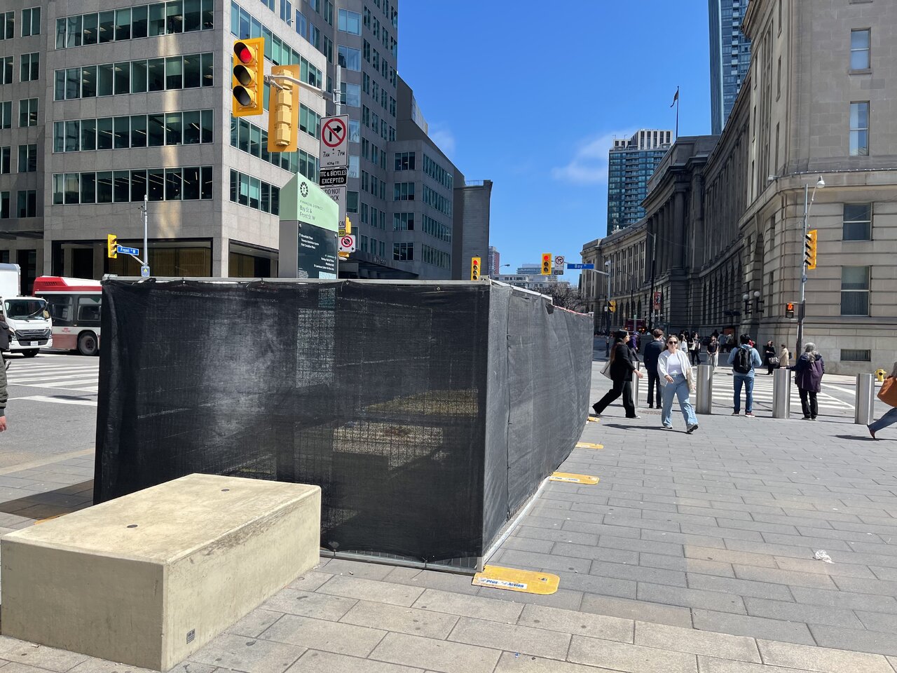
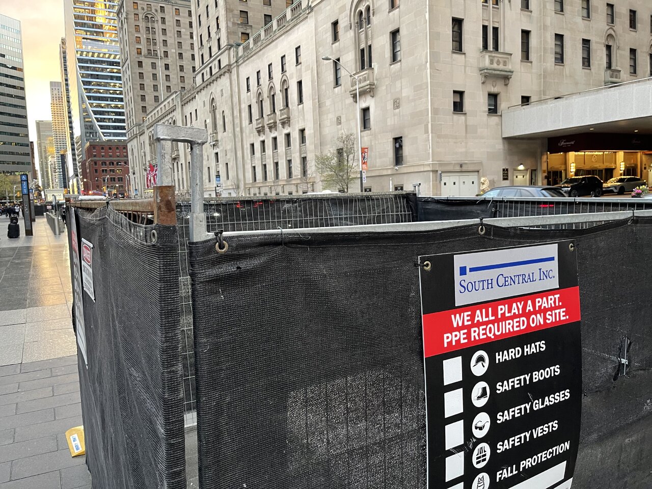
Another block was put in fence jail. This time a single block somewhere in the middle of other blocks. The ones on the corner of Bay and Front are still fenced in. Nothing has happened at all there. This may be a deficiencies correction as South Central are finally reducing the size of the fencing near their trailer and are probably preparing to complete the years long job.

IMG_3409.jpeg


IMG_3052.jpeg


The scope of the work was primarily sealing the sidewalk to prevent leaks in the moat and streetcar platforms below. If I had to guess, these blocks were fenced in to correct continued leaks in those locations.
 
When is the new Southern Concourse (USEP) suppose to open by?

The entire project is due in 2029 though the concourse may open in stages. The western side of the Bremner Concourse is substantially complete with electrical being installed now and interior finishings beginning soon. I think within a year, we might see the Bremner Concourse from York to about the VIA concourse open while everything east of it continues for the next couple of years.
 
(Oh boy.)
TTC launches new wayfinding pilot at six stations ahead of FIFA World Cup 2026TM this summer

May 5, 2026

With the FIFA World Cup 2026TM less than 40 days away, the TTC has launched a pilot project that will make it easier for customers to find their way through some of the busiest subway stations.

The pilot introduces a new alpha-numeric identification system for station exits, transfer points, and other key locations. Each exit will now be marked with a simple code—such as “A” or “A 1”— designed to make subway stations easier to navigate, improve transfers, and help visitors and daily riders move through the space more confidently.

The new system will use simple alphabetical zones and pedestrian icons to help customers pinpoint their street-level destinations. For example, at Bathurst Station, the Bathurst St. side becomes Zone A, while the Markham St. side becomes Zone B. Each zone is linked to nearby landmarks, street corners, and transit connections, making it easier for customers to choose the most appropriate exit.

Six high-traffic stations were selected for the initial pilot: Bathurst, Dufferin, Bloor-Yonge, Union, St Andrew, and King. These stations are important transfer points and will be popular locations during the FIFA World Cup 2026TM.

With thousands of visitors expected this summer, improved navigation will help reduce congestion and keep transit and pedestrian traffic moving safely and efficiently.

Customers will begin noticing new yellow directional signage in stations beginning today, as well as updated signage listing local destinations and corresponding exit codes. This information will also be integrated in the TTC’s public data, allowing third-party transit apps to guide riders directly to a specific entrance/exit.

The pilot will operate from June to September 2026. During this period, the TTC will gather customer feedback and evaluate how well the new system improves navigation.

-30-
 
This should be fun
IMG_7201.png
IMG_7202.png
IMG_7203.png
The pilot introduces a new alpha-numeric identification system for station exits, transfer points, and other key locations. Each exit will now be marked with a simple code—such as “A” or “A 1”— designed to make subway stations easier to navigate, improve transfers, and help visitors and daily riders move through the space more

Six high-traffic stations were selected for the initial pilot: Bathurst, Dufferin, Bloor-Yonge, Union, St Andrew, and King. These stations are important transfer points and will be popular locations during the FIFA
 
(Oh boy.)
TTC launches new wayfinding pilot at six stations ahead of FIFA World Cup 2026TM this summer

May 5, 2026

With the FIFA World Cup 2026TM less than 40 days away, the TTC has launched a pilot project that will make it easier for customers to find their way through some of the busiest subway stations.

The pilot introduces a new alpha-numeric identification system for station exits, transfer points, and other key locations. Each exit will now be marked with a simple code—such as “A” or “A 1”— designed to make subway stations easier to navigate, improve transfers, and help visitors and daily riders move through the space more confidently.

The new system will use simple alphabetical zones and pedestrian icons to help customers pinpoint their street-level destinations. For example, at Bathurst Station, the Bathurst St. side becomes Zone A, while the Markham St. side becomes Zone B. Each zone is linked to nearby landmarks, street corners, and transit connections, making it easier for customers to choose the most appropriate exit.

Six high-traffic stations were selected for the initial pilot: Bathurst, Dufferin, Bloor-Yonge, Union, St Andrew, and King. These stations are important transfer points and will be popular locations during the FIFA World Cup 2026TM.

With thousands of visitors expected this summer, improved navigation will help reduce congestion and keep transit and pedestrian traffic moving safely and efficiently.

Customers will begin noticing new yellow directional signage in stations beginning today, as well as updated signage listing local destinations and corresponding exit codes. This information will also be integrated in the TTC’s public data, allowing third-party transit apps to guide riders directly to a specific entrance/exit.

The pilot will operate from June to September 2026. During this period, the TTC will gather customer feedback and evaluate how well the new system improves navigation.

-30-
This seems more similar to how Japanese metros (which is far superior) so it could be better.
1778038780026.jpeg
 
This seems more similar to how Japanese metros (which is far superior) so it could be better.
Both Japanese and Chinese systems utilize number exits for wayfinding for stations. I find it works better in China as all of the stations are uniform in design but it's more helpful in Japan where all of the stations are a mismash of design and layout. We land somewhere in the middle of those two.

My takeaway from poking around King is that the station would benefit from platform-level station maps indicating these lettered exits.

One of the main issues with the King rollout is that the list of exits is posted near the stairs/escalator out, so if someone stops to look at it they'll be blocking people trying to exit. I blocked people queuing for the stairs just by taking a quick photo of it.
 
One of the main issues with the King rollout is that the list of exits is posted near the stairs/escalator out, so if someone stops to look at it they'll be blocking people trying to exit. I blocked people queuing for the stairs just by taking a quick photo of it.

Do you reckon the new numbering might actually cause people to pause ... more than the existing signage currently does?

Edit: General discussion here: https://urbantoronto.ca/forum/threads/ttc-cartography-signage-and-wayfinding.20334/page-54
 
Zombie Pole #2 (the concrete one) is being prepared to be taken down. They were removing signs today.

Screenshot 2026-05-08 at 1.37.11 PM.png


Zombie Pole #1 (the wooden heritage pole) is still untouched.

Meanwhile they've updated the blocks... what in the "design is my passion" is this???
IMG_3614.jpeg


IMG_3613.jpeg


Note: I've decided to stop posting here as some members have made it known that they don't appreciate the amount of time and effort it takes to walk around the city, photograph, research, write and publish updates every day — it's a community, nobody expects to be paid but neither expects to being insulted — but I couldn't pass up sharing these updates. I'll continue visiting periodically. Thanks to everyone who contributes.
 

Back
Top