Can they get ever more useless than this? If there is a place to engineer resiliency, it would be the transportation hub of the city.

Oh and on top of that - they had closed almost the entire width of the staircase from the Bay Teamway down into the lower concourse since at least Friday.

AoD
 
Last edited:
The seventh map in my series of Toronto Union Station maps is finished.

This layer focuses on the ground level portion of Union Station west of York Street:

• York West Teamway
• Skywalk Lower Level
• Union Station Complex Entrances
• North-west Station Entrance

You_Doodle+_2025-07-25T04_44_34Z.jpeg


I’ve now mapped out the entire ground level of the Union Station complex, from Simcoe to Yonge Street:

You_Doodle+_2025-07-25T05_07_51Z.jpeg
 
Last edited:
Beautifully done @WB62! (Stamp of approval from former MapArt Managing Editor.) I do have a couple of notes though... Send me a message if interested!

42
 
The ultimate cause has been identified as rain 😂.

More accurately, it's that the Lake Shore/Front street area is south of the natural shoreline of Lake Ontario if it weren't for infilling, and building anything below ground level is always going to lead to accumulation of water here. The underpass at Bremner and Simcoe is particularly vulnerable and every couple years we'll see a car or two submerged there when some genius tries to drive through when it's flooded.
 
More accurately, it's that the Lake Shore/Front street area is south of the natural shoreline of Lake Ontario if it weren't for infilling, and building anything below ground level is always going to lead to accumulation of water here. The underpass at Bremner and Simcoe is particularly vulnerable and every couple years we'll see a car or two submerged there when some genius tries to drive through when it's flooded.
Front traces the north side of the original shoreline. Whether the buildings and roads south of Front are on former lake or not, the City and its related agencies as well as private concerns building on former lake land, especially when it comes to a major transportation hub, need to engineer what they build to handle heavy downpours. The lake simply is not an excuse as concerns flooding in Union Station. Something needs to be done to limit water ingress during major rain events, and there are a number of options available to those involved. That includes shelters over the two Front Street sidewalk staircases down into the station, adding one more step above sidewalk level to prevent sidewalk water running in, same thing at the moat level entries, and most expensive, grilles at the lowest steps covering new gutters to channel water away to new cisterns from where the water can be pumped out. Try the other two measures first, and they probably won't need the third. It's pathetic that these features were not designed into the station renovations in the first place.

42
There are even more aggressive barriers available:


The transportation nexus of the city ought to be a candidate for a heightened level of protection - especially from a city administration that have previous knowledge of the vulnerability of this piece of infrastructure. Stop telling me you have a wet weather master plan - demonstrate it.

(Guess their galaxy brains will take another 7 years to figure it out).

AoD
 
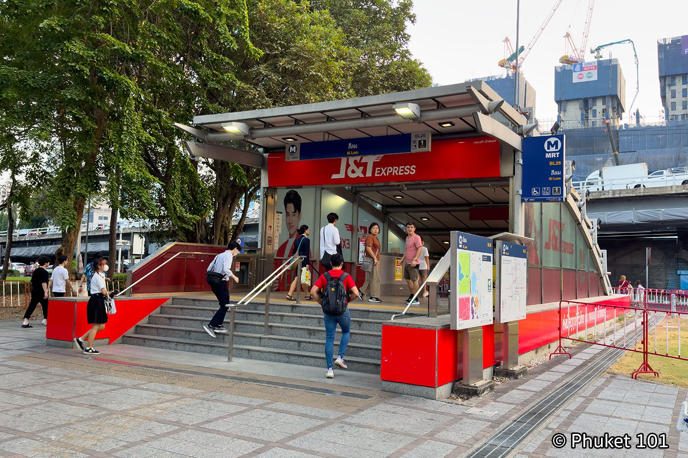
Here's how they do it at MRT stations in Bangkok, a city prone to torrential rain and widespread flooding: just put the entrances above flood level.

MRT-Station.jpg

Source

On Front Street, where the land slopes away at York and Bay streets (and therefore water is not likely to rise more than a couple centimetres on the sidewalk), a single step up should do the trick. At the moat entrances along York and Bay Streets, grilles with cisterns below may be needed assuming they don't want to lose barrier-free access.

42
 

Back
Top