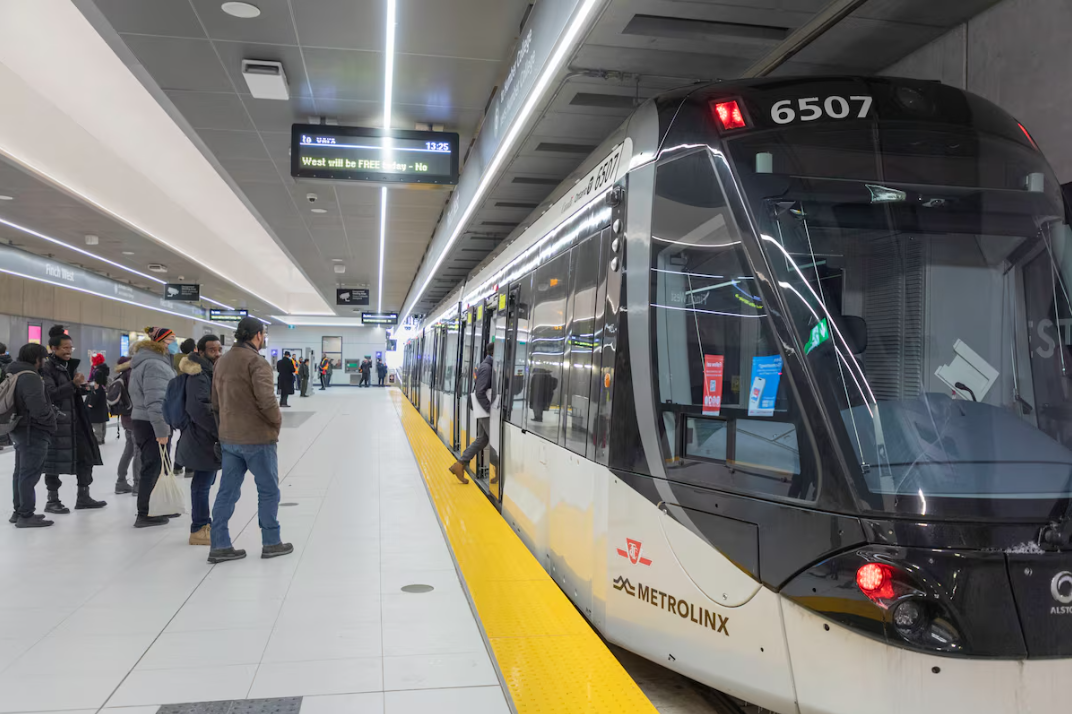
News   GLOBAL  |  Apr 02, 2020
 11K     0 
News   GLOBAL  |  Apr 01, 2020
 43K     0 
News   GLOBAL  |  Apr 01, 2020
 6.8K     0 
lol wrong. The finch 36 doesn’t come every two minutes but nice try. Especially not the ones that have to run when the LRT is broken or not running and end up blocking the reduced lane ways that motorists now have to contend with because literally everyone at Metrolinx is incapable.
We are not talking about 36 Finch vs. BRT. We are talking about LRT vs. BRT. If LRT runs every 6 minutes, bus would need 2 minutes to match that.

36 Finch doesn't run 2 minutes, but you don't build BRT on Finch to match the ridership of the 36 Finch. You build BRT with the expectation that the ridership will be higher the 36 Finch, and for higher ridership the frequency would also need to be higher, unless they use double articulated buses.
 
The existing Finch LRT only runs parallel to the hydro corridor for 3 km, from Keele to Hwy 400. After that, the hydro corridor swings sharply to the south-west.

Potentially, an eastern extension towards Yonge (and past Yonge?) could use the corridor. However, would have to deal with:
- Reluctance on the part of Hydro who does not want to deal with LRT when they need to repair their lines
- Additional safety concerns; what happens if a hydro wire falls on the rail?
- Opposition of the residents whose houses are located right next to the hydro corridor
- Opposition of other residents who live south of Finch and will complain that the LRT is too far from them
- G Ross Lord pond east of Dufferin; the wires just run over, but the LRT would need a bridge or a diversion
Yeah I think those 3 km would have been better off in the hydro corridor to save a few minutes. Obviously it's too late now.

I don't think the eastern extension makes sense in general. It's 6 km from Finch West station to Finch Station, but it's only 4 km from Sheppard West station to Sheppard-Yonge station. So it's probably worth spending a bit extra to extend the Sheppard Subway west rather than extending the Finch LRT east.
 
Thanks for this! I'll copy the data into my own spreadsheet so I can play around with it.
Oop. Hope I am not too late but I can just toss you the data.

Here's a link to my spreadsheet full of transit data I record, data for this is on sheet "Speeds, HOT". I was going to upload it to Google Drive to be viewable in browser but I don't have a google account on my e-mail and google verification thing just hung up on me when I tried to sign up... Thanks, google.

At @a2z 's suggestion I have added the Frankfurt U2. It's cut off but the note is that the tram dwells for 60s swapping operators, and I don't think it's particularly relevant.

1768868156916.png
 
There are many streets that can accommodate this configuration city-wide. Basically every major arterial in Etobicoke, Scarborough, and North York has the space.
And the St. Clair streetcar is renowned for its slow speeds, sometimes slower than the bus replacement. Sound familiar? The St. Clair example is also dubious because the sidewalks are narrow, the setbacks and non-sidewalk boulevards often non-existent. This wouldn't fly in a future tram project in Toronto. It's also over a century old. Two decades ago, it was politically acceptable for the whole ROW to get torn up for slightly more grade separation because the line already existed. It would not be acceptable for a non-streetcar road to be torn up for a new project that would induce setback zoning violations along the entire corridor.
 
And the St. Clair streetcar is renowned for its slow speeds, sometimes slower than the bus replacement. Sound familiar? The St. Clair example is also dubious because the sidewalks are narrow, the setbacks and non-sidewalk boulevards often non-existent. This wouldn't fly in a future tram project in Toronto. It's also over a century old. Two decades ago, it was politically acceptable for the whole ROW to get torn up for slightly more grade separation because the line already existed. It would not be acceptable for a non-streetcar road to be torn up for a new project that would induce setback zoning violations along the entire corridor.
As someone who takes the 512 daily. It's actually pretty good. And when there are replacement buses ridership completely collapses. The difference is stark, people simply take alternative routes because they know it will be slower.

After the route opened it was pretty slow, but after some changes made by Andy Byford's team it improved a lot. After the pandemic the route became virtually unusable, it was as though they forgot every lesson they learned managing the route. It also seems like they do a lot of training along the route.

Last year the TTC launched a Bunching and Gapping pilot project (https://www.toronto.ca/legdocs/mmis/2025/ttc/bgrd/backgroundfile-259672.pdf) which worked really well for the route imo. and in fact, the 512 St Clair's average speed is now slightly faster than the Finch West LRT.

St Clair also probably has some of the widest sidewalks in the city between blocks, but the choice was made to retain left turning lanes at the expense of sidewalk width at intersections some of which are unacceptably narrow. Hopefully this is mitigated when St Clair is rebuilt.

The St Clair ROW didn't just offer slightly more grade separation it's important to remember many stops boarded curbside requiring 2 lanes of traffic to stop and cars often turned left infront of streetcars. The whole street was rebuilt, the sewers, the gas lines, hydro wires, the road bed, the tracks, the sidewalks. It was a nightmare.

The line was completed in 2010 and by 2012 homes along the route were worth 35 to 40% more.

Cars travel faster than before, streetcars are faster and more reliable. And the ROW is likely responsible for more economic development than any other project in the city since Line 4. The real estate values along the route are some of the most appreciated in the country since its completion, and the route has spurred some of the most high end residential projects in the city's history.

The project allowed the city to create a unique urban environment on St Clair, just as they had done on Spadina years earlier. Unique shelters, light poles, street furniture etc. You couldn't mistake these streets with anywhere else.

Unfortunately the same cannot be said for Finch, I think there were a lot of missed opportunities to create a unique urban experience on the route. And considering the 512 is currently faster than the Finch West LRT I don't doubt the TTC, with over 100 years of experience building and rebuilding Light rail lines, would have done a far better job.

That said, St Clair is still too slow. And it's imperative that the city implements full signal priority as soon as possible.
 
As someone who takes the 512 daily. It's actually pretty good. And when there are replacement buses ridership completely collapses. The difference is stark, people simply take alternative routes because they know it will be slower.

After the route opened it was pretty slow, but after some changes made by Andy Byford's team it improved a lot. After the pandemic the route became virtually unusable, it was as though they forgot every lesson they learned managing the route. It also seems like they do a lot of training along the route.

Last year the TTC launched a Bunching and Gapping pilot project (https://www.toronto.ca/legdocs/mmis/2025/ttc/bgrd/backgroundfile-259672.pdf) which worked really well for the route imo. and in fact, the 512 St Clair's average speed is now slightly faster than the Finch West LRT.

St Clair also probably has some of the widest sidewalks in the city between blocks, but the choice was made to retain left turning lanes at the expense of sidewalk width at intersections some of which are unacceptably narrow. Hopefully this is mitigated when St Clair is rebuilt.

The St Clair ROW didn't just offer slightly more grade separation it's important to remember many stops boarded curbside requiring 2 lanes of traffic to stop and cars often turned left infront of streetcars. The whole street was rebuilt, the sewers, the gas lines, hydro wires, the road bed, the tracks, the sidewalks. It was a nightmare.

The line was completed in 2010 and by 2012 homes along the route were worth 35 to 40% more.

Cars travel faster than before, streetcars are faster and more reliable. And the ROW is likely responsible for more economic development than any other project in the city since Line 4. The real estate values along the route are some of the most appreciated in the country since its completion, and the route has spurred some of the most high end residential projects in the city's history.

The project allowed the city to create a unique urban environment on St Clair, just as they had done on Spadina years earlier. Unique shelters, light poles, street furniture etc. You couldn't mistake these streets with anywhere else.

Unfortunately the same cannot be said for Finch, I think there were a lot of missed opportunities to create a unique urban experience on the route. And considering the 512 is currently faster than the Finch West LRT I don't doubt the TTC, with over 100 years of experience building and rebuilding Light rail lines, would have done a far better job.

That said, St Clair is still too slow. And it's imperative that the city implements full signal priority as soon as possible.

I admit, St. Clair is actually better than Line 6, but I didn't want to throw too many caveats in the previous post so as to weaken the point. St. Clair is 2 km from the 'official' downtown, and some would argue it is downtown.

It's my hypothesis that there are no corridors that warrant an upgrade to tram that are also currently wide enough to fit a tram. Unless one or more of the following happens to the corridor: infeasible changes that would violate municipal code and/or zoning by-laws, and/or expropriation.

2024 TTC Daily Bus Boardings:
Finch East (39 + 939) — 43,048
Lawrence West (52 + 952) — 42,077
Dufferin (29 + 929) — 40,750
Finch West (36) — 39,541
Jane (35 + 935) — 37,464
Wilson (96 + 996) — 34,469
Lawrence East (54 + 954) — 33,594
Don Mills (25 + 925) — 32,705
Eglinton West (32) — 32,221
Markham Road (102 + 902) — 31,659
Steeles West (60 + 960) — 30,141
York Mills (95 + 995) — 25,832
Sheppard West (84 + 984) — 23,509
Sheppard East (85 + 985) — 22,490
Steeles East (53 + 953) — 20,859

To the perennially pro-LRT crowd I ask: where can we find ROWs wide enough, and with boardings per km high enough to support an upgrade to tram in the City of Toronto?

I hear people drone on about how great LRTs are, how they definitely wOrK In oThEr cItIeS, while conveniently ignoring cities entirely devoid of them such as New York City and most metro-having cities in Mainland China (34 out of 46 have metro, but no tram). Or nearly entirely devoid of them like Tokyo or London, with 17.2 and 28 km respectively to Toronto's 93.3 km, soon to be 100+ km.

The mere existence of larger cities that have built or are still building tram does not prove that Toronto should continue building trams, especially in the short term. The very same argument can be made against trams when you consider cities as big or bigger that have no trams. Both arguments are weak and subject to selection bias and false equivalences to varying degrees. That trams may 'work' in other cities does not prove their cost-effectiveness in Toronto when the streets are so narrow, among other urban-morphological and political constraints.

So where exactly are future trams supposed to 'work' beyond Lines 5, 6 and Waterfront? I support the completion of tram projects at hand, but I don't support any further projects. And if my hypothesis is correct, then my support is irrelevant when adding trams to Toronto streets is so physically and politically infeasible.

Street ROW widths property line to property line: https://map.toronto.ca/torontomaps/ Feature Filter>Properties>Property Parcel; Measurement
 
Last edited:
You are questioning whether these corridors have the ridership to justify LRT, but also suggesting Toronto build subways everywhere like NYC and Tokyo?

I think Wilson-Rexdale-Derry, Lawrence East, and Kingston-Highway 2 are good candidates for future light rail. In 905, there Queen in Brampton. That's pretty much it.

Given Toronto's suburban nature, it's mostly a choice between building LRT or doing nothing. Scarborough ain't Queens, and North York ain't The Bronx.
 
You are questioning whether these corridors have the ridership to justify LRT, but also suggesting Toronto build subways everywhere like NYC and Tokyo?

I think Wilson-Rexdale-Derry, Lawrence East, and Kingston-Highway 2 are good candidates for future light rail. In 905, there Queen in Brampton. That's pretty much it.

Given Toronto's suburban nature, it's mostly a choice between building LRT or doing nothing. Scarborough ain't Queens, and North York ain't The Bronx.

No thanks.
 
I admit, St. Clair is actually better than Line 6, but I didn't want to throw too many caveats in the previous post so as to weaken the point. St. Clair is 2 km from the 'official' downtown, and some would argue it is downtown.

It's my hypothesis that there are no corridors that warrant an upgrade to tram that are also currently wide enough to fit a tram. Unless one or more of the following happens to the corridor: infeasible changes that would violate municipal code and/or zoning by-laws, and/or expropriation.

2024 TTC Daily Bus Boardings:
Finch East (39 + 939) — 43,048
Lawrence West (52 + 952) — 42,077
Dufferin (29 + 929) — 40,750
Finch West (36) — 39,541
Jane (35 + 935) — 37,464
Wilson (96 + 996) — 34,469
Lawrence East (54 + 954) — 33,594
Don Mills (25 + 925) — 32,705
Eglinton West (32) — 32,221
Markham Road (102 + 902) — 31,659
Steeles West (60 + 960) — 30,141
York Mills (95 + 995) — 25,832
Sheppard West (84 + 984) — 23,509
Sheppard East (85 + 985) — 22,490
Steeles East (53 + 953) — 20,859

A few thoughts here.

First, lets pull out from the above those routes that will be subway/metro etc.

Don Mills (25 + 925) — 32,705 - Ontario Line and Ontario Line North Extension

Eglinton West (32) — 32,221 - Eglinton West LRT Extension (fully grade separated); + extension to Pearson.

Sheppard West (84 + 984) — 23,509 - Sheppard Subway
Sheppard East (85 + 985) — 22,490 - Sheppard Subway

Of the remainder:

LRT is not even remotely contemplated for:

Lawrence West, Dufferin, Wilson, York Mills, Lawrence East, Markham Rd, and Finch East

Roads/Routes with LRT discussed, at some level, seriously (not necessarily under active consideration)

Eglinton East (of Kennedy), Kingston Road (Eglinton to Morningside), Morningside, Sheppard East (of McCowan), Jane, Finch West (to Yonge), WWLRT to Dufferin, Finch West to Pearson.

To the perennially pro-LRT crowd I ask: where can we find ROWs wide enough, and with boardings per km high enough to support an upgrade to tram in the City of Toronto?

I am not in the unabashedly pro-LRT crowd, but I'm not in the bash it crowd either. Finch as executed/operated is a fail; but assuming we did it properly, its not an inherently terrible medium.

With that said, I oppose the EELRT as currently contemplated as it has failed several tests I've laid out including faster journey times for riders, and comes at a projected cost so high that is plausible to discuss achieving better outcomes with a combination of BRT and Subway for similar sums.

Of the remainder, EWLRT to Pearson I support, Finch extension I would place on pause until we see how well we remedy the issues on the existing line, WWLRT to Dufferin I support. Jane I haven't modeled out to form a clear opinion on.

I hear people drone on about how great LRTs are, how they definitely wOrK In oThEr cItIeS, while conveniently ignoring cities entirely devoid of them such as New York City and most metro-having cities in Mainland China (34 out of 46 have metro, but no tram). Or nearly entirely devoid of them like Tokyo or London, with 17.2 and 28 km respectively to Toronto's 93.3 km, soon to be 100+ km.

Ok, can we leave the goofy lettering out please, it does not add credibility and it removes readability.

Street ROW widths property line to property line: https://map.toronto.ca/torontomaps/ Feature Filter>Properties>Property Parcel; Measurement

ROW map here:

1768918396183.png


Anything in red can easily support LRT, dark blue may be feasible (St. Clair was) but will likely have more trade-offs.
 
You are questioning whether these corridors have the ridership to justify LRT, but also suggesting Toronto build subways everywhere like NYC and Tokyo?

I think Wilson-Rexdale-Derry, Lawrence East, and Kingston-Highway 2 are good candidates for future light rail. In 905, there Queen in Brampton. That's pretty much it.

Given Toronto's suburban nature, it's mostly a choice between building LRT or doing nothing. Scarborough ain't Queens, and North York ain't The Bronx.

When exactly did I ever say 'build subways everywhere'?? Give me the quote. I've made over close to two dozen posts saying Finch should have gotten tram later in hindsight, and definitely not a subway.

What a wild and pervasive strawman against pro-subway / pro-grade separation people.

It's not really about pro-LRT vs. pro-subway. As I've said earlier: grade separation matters much more for speed and service reliability. It's a romantic notion to expect wide stop spacing and subway speeds on median or roadside trams. Wide spacing would necessitate parallel bus service, which decreases the environmental and economic benefits. Cases like Calgary have large segments that function like the surface and underground sections of the Toronto subway and also run high floor trains.

Rolling stock choice of narrower, shorter consists for tram vs. wider, longer metro, has more to do with operational economics; the decision should be made based on projected transit demand.

Most of these bus corridors do not come close to the daily boardings per km to justify upgrade to tram (even if extrapolating for latent demand), let alone light or heavy metro.

Why no tram in hindsight? Finch West had just over 3,000 daily boardings per km in Fall 2019 when its boardings were 55,000. For reference, Line 1 and 2 are around 16,000 boardings per km in 2025. Finch West is down to 40,000 in 2024. Neither number is high enough to necessitate immediate tram upgrade for 10 km of the route. There are only 3 mid and high-rise developments near Finch West, all in pre-construction. Densification isn't happening anytime soon unfortunately.

I'm still content with Line 6 being built as a learning opportunity and because Toronto always procrastinates on transit, so it's a good thing they built something early for once.

"Given Toronto's suburban nature". Toronto would be the third largest city in Western Europe (population over a similar area), behind only London and Paris. And it certainly isn't smaller than most of those 34 Chinese cities (30 of which you've never heard of) that have only metro. It's only North American-ly suburban in that it has a lot of house-lined, comparatively narrow arterials.

China has very few tram lines due to robust alternative last-mile transport options, intentional urban design, and better economies of scale with metro and much more. People there like walking and China is huge on bike sharing services. Chinese urban arterials are designed with high capacity car lanes in the centre, while cyclists and pedestrians are segregated onto parallel side paths and sidewalks. Arterials in Mainland China are standardized and significantly wider than Toronto arterials (think 40+ metres), both curb-to-curb and property line to property line. In many ways, China has city streets that are much more suited to trams, and yet they do not build them.

So many pro-LRT advocates fallaciously extrapolate that just because X city has half-decent trams, therefore they would work in Toronto. That is a false equivalence. They're treating fundamentally different urban contexts as if they were equivalent.

They are asking for a move away from car-centric design in a place with streets too narrow for fast trams, along with some of the highest car ownership rates in the world. Vast majority of Toronto arterials are no wider than 26 metres property line to property line at their narrowest segments. That will not fit four car lanes, a tram, a meaningful sidewalk and a stop platform. This is a big reason why Line 6 was not built towards Yonge and beyond. The ROW was already much wider west of Keele.

You cannot merely copy and paste fast trams like Calgary CTrain or the Utrecht Sneltram into Toronto, both of which are borne of compromise between low-density suburbs and mid-density downtowns with extensive use of pre-existing railway ROWs, massively wide streets (10 + lanes equivalent, 40+ metres) and wide tracts of land that don't exist in Toronto except for the hydro corridors. I've touched on this before, it's not feasible to run low or high floor trams on previous freight or Metrolinx rail through leasing or acquisition. Any urban rail run on railway ROWs would be metros or RERs like the Ontario Line or Line 1 Yonge extension. And there is little to no difference between high floor trams and metro in the first place.
Anything in red can easily support LRT, dark blue may be feasible (St. Clair was) but will likely have more trade-offs.
@Northern Light As we've discussed on an earlier page, the red cannot easily support tram/LRT, those are planned widths, not actual widths. Steeles is the notable exception. Large segments, if not the majority of York Mills, Finch etc. are listed as 36 metres in the Official Plan but are only 25-26 metres wide property line to property line, which also leads to the issue of setbacks if expropriation is needed. The narrowest sections strongly influence tram retrofit viability, even if the widest parts approach or exceed 30 metres. You can check for yourself for potential LRT corridors on https://map.toronto.ca/torontomaps/ and compare to the Official Plan ROW map https://www.toronto.ca/wp-content/uploads/2017/11/984d-cp-official-plan-Map-03_OP_ROW_AODA.pdf.

Here is an example of a '36' metre ROW section that is more like 20 metres. Even property line to property line doesn't account for geography like deep ditches, ravines, cliffs, and freight ROWs in south Bayview's case, so checking other sources or going there in-person helps. (Of course most trams are not going to climb Bayview's steep grade). The faster street running trams in Europe are usually built on comparatively wide ROWs, sometimes with slip roads. Slip roads are virtually non-existent in Toronto. Previously I've compared Finch to Brussels and Frankfurt, the latter highlighted sections ran on wider public ROWs.

1768922467034.png
1768920872022.png

1768921288990.png
1768921397835.png


For Jane LRT, we can immediately rule out Bloor to Dundas at-grade, the bare minimum is 25 metres property line to property line and that's mid-block with no extra room for tram stops or turning lanes. This is something I forgot to mention previously: For mid-block with split side stops, you need closer to 30 metres minimum, even more with two-way centre platforms and at intersections for extra turning lanes. In these cases there is virtually no boulevard except the 2.1 metre sidewalk on each side. Jane does not get wide enough for tram until briefly near Eglinton Flats, becoming too narrow near Weston and Lawrence again.

(edit: I forgot to account for an extra 2-3 metres construction buffer on each side for street widening. Broadly 3 options: voluntary Temporary Construction Easements, as well as expropriations of a temporary or permanent interests. To rebuild a sidewalk right up against the property line, you would end up with equipment and workers standing on private property. The cost to do this legally would be more expensive than a redesign or reroute to a suitably wider street. Land owners can refuse a TCE, and expropriation compensation can be disputed in court, even after the 2020 Building Transit Faster Act. The true width needed is closer to 29-30 mid-block without stops, 32-33 mid block with stops, and 35-36 metres at intersections with stops and turning lanes)

The Jane LRT is dead. The ROW is not consistently wide enough south of Wilson. I can post screenshots showing the same thing on other potential LRT corridors later.

1768924656891.png
1768924703615.png
 
Last edited:
I find it odd that people correlate Finch West's bad performance with the viability of LRT as a whole. You can argue that it's executed poorly, but to argue that it's not a viable form of transit in the context of Toronto is uninformed.

You are questioning whether these corridors have the ridership to justify LRT, but also suggesting Toronto build subways everywhere like NYC and Tokyo?

I think Wilson-Rexdale-Derry, Lawrence East, and Kingston-Highway 2 are good candidates for future light rail. In 905, there Queen in Brampton. That's pretty much it.

Given Toronto's suburban nature, it's mostly a choice between building LRT or doing nothing. Scarborough ain't Queens, and North York ain't The Bronx.

At the same time this argument is just as shortsighted. While LRT is almost perfect for some streets in the outer Boroughs, to be efficient they need to feed into higher orders of transit.

For example a potential Eglinton East LRT would feed into Guildwood and Eglinton GO stations as well as Kennedy. A potential Lawrence East LRT could feed into an Ontario Line Extension at Don Mills, a potential GO station along the Unionville Sub, and Lawrence East Station along the Line 2 extension.

These different pieces of the puzzle are to work in tandem.

When exactly did I ever say 'build subways everywhere'?? Give me the quote. I've made over close to two dozen posts saying Finch should have gotten tram later in hindsight, and definitely not a subway. What a wild and pervasive strawman against pro-subway / pro-grade separation people. It's not really about pro-LRT vs. pro-subway. As I've said earlier: grade separation matters much more for speed and service reliability. It's a romantic notion to expect wide stop spacing and subway speeds on median or roadside trams. Wide spacing would necessitate parallel bus service, which decreases the environmental benefits. Cases like Calgary have large segments that function like the surface and underground sections of the Toronto subway and also run high floor trains.

Rolling stock choice narrower, shorter consists for tram vs. wider, longer metro, is more about operational economics.

Most of these bus corridors do not come close to the daily boardings per km to justify upgrade to tram (even if extrapolating for latent demand), let alone light or heavy metro.

Why no tram in hindsight? Finch West had just over 3,000 daily boardings per km in Fall 2019 when its boardings were 55,000. For reference, Line 1 and 2 are around 16,000 boardings per km in 2025. Finch West is down to 40,000 in 2024. Neither number is high enough to necessitate immediate tram upgrade for 10 km of the route. There are only 3 mid and high-rise developments near Finch West, all in pre-construction. Densification isn't happening anytime soon unfortunately.

I'm still content with Line 6 being built as a learning opportunity and because Toronto always procrastinates on transit, so it's a good thing they built something early for once.

"Given Toronto's suburban nature". Toronto would be the third largest city in Western Europe (population over a similar area), behind only London and Paris. And it certainly isn't smaller than most of those 34 Chinese cities (30 of which you've never heard of) that have only metro.

China has very few tram lines due to robust alternative last-mile transport options, intentional urban design, and better economies of scale with metro and much more. People there like walking and China is huge on bike sharing services. Chinese urban arterials are designed with high capacity car lanes in the centre, while cyclists and pedestrians are segregated onto parallel side paths and sidewalks. Arterials in Mainland China are standardized and significantly wider than Toronto arterials, both curb-to-curb and property line to property line. In many ways, China has city streets that are much more suited to trams, and yet they do not build them.

So many pro-LRT advocate fallaciously extrapolate that just because X city has half-decent trams, therefore they would work in Toronto. That is a false equivalence. They're treating fundamentally different urban contexts as if they were equivalent.

They are asking for a move away from car-centric design in a place with streets too narrow for fast trams, along with some of the highest car ownership rates in the world. Vast majority of Toronto arterials are no wider than 26 metres at their narrowest segments. That will not fit four car lanes and a tram. This is a big reason why Line 6 was not built towards Yonge and beyond. The ROW was already much wider west of Keele.

You cannot merely copy and paste Calgary CTrain or the Utrecht Sneltram into Toronto, both of which are borne of compromise between low-density suburbs and mid-density downtowns with extensive use of pre-existing railway ROWs, massively wide streets (10 + lanes equivalent, 40+ metres) and wide tracts of land that don't exist in Toronto except for the hydro corridors. I've touched on this before, it's not feasible to run low or high floor trams on previous freight or Metrolinx rail through leasing or acquisition. Any urban rail run on railway ROWs would be metros or RERs like the Ontario Line or Line 1 Yonge extension. And there is little to no difference between high floor trams and metro in the first place.

As we've discussed on an earlier page, the red cannot easily support tram/LRT, those are planned widths, not actual widths. Steeles is the notable exception. Large segments, if not the majority of York Mills, Finch etc. are only 25-26 metres wide. The narrowest sections strongly influence tram retrofit viability. You can check for yourself for potential LRT corridors on https://map.toronto.ca/torontomaps/

When you look at Toronto's geographical history with LRTs, it's obvious that they act as seeds for retail, density and development. Nearly all of Toronto's most notable and culturally rich avenues have or have had LRTs in the past. We replace buses with LRTs not only to increase capacity and speed but as a city building project. They encourage street walls, mixed use communities, and mid-density developments One needs only to glance at the new developments on St Clair or the Golden Mile to understand. It's also notable that Line 5 Eglinton spurred most of its recent residential developments along the in median sections of the route.

Does this mean it will work everywhere? No. But it allows Toronto build its urban fabric outwards into the outer boroughs in a way that's less nodal and most consistent. So they too can have the same liveable, diverse built environments that's usually reserved for the urban elites.
 
Last edited:
When you look at Toronto's geographical history with LRTs, it's obvious that they act as seeds for retail, density and development. Nearly all of Toronto's most notable and culturally rich avenues have or have had LRTs in the past. We replace buses with LRTs not only to increase capacity and speed but as a city building project. They encourage street walls, mixed use communities, and mid-density developments One needs only to glance at the new developments on St Clair or the Golden Mile to understand. It's also notable that Line 5 Eglinton spurred most of its recent residential developments along the in median sections of the route.

Does this mean it will work everywhere? No. But it allows Toronto build its urban fabric outwards into the outer boroughs in a way that's less nodal and most consistent. So they too can have the same liveable, diverse built environments that's usually reserved for the urban elites.
I substantially agree, besides Line 5, which would've spurred development as light metro or anything beyond the existing bus really. Having spent some time looking at the ROW widths in Toronto of the busiest bus corridors, I just don't see future trams outside of 5, 6 and Waterfront being feasible. If pressed forward, would incur the wrath of NIMBYs to the likes we've never seen. The steep grades north of Bloor also preclude northward expansion of the current streetcar network.

I like trams. I prefer trams for shorter trips. I also don't think future trams would be appropriate, much less optimal in the current built form of Toronto. Tearing down large swaths of the city to build wide arterials like China would never happen in Canada.

I don't think you can change the ethos without changing the built form of those suburban streets ultimately.
Therein lies the problem with future trams in Toronto.
 
@Northern Light As we've discussed on an earlier page, the red cannot easily support tram/LRT, those are planned widths, not actual widths. Steeles is the notable exception. Large segments, if not the majority of York Mills, Finch etc. are listed as 36 metres in the Official Plan but are only 25-26 metres wide property line to property line, which also leads to the issue of setbacks if expropriation is needed. The narrowest sections strongly influence tram retrofit viability, even if the widest parts approach or exceed 30 metres. You can check for yourself for potential LRT corridors on https://map.toronto.ca/torontomaps/ and compare to the Official Plan ROW map https://www.toronto.ca/wp-content/uploads/2017/11/984d-cp-official-plan-Map-03_OP_ROW_AODA.pdf. Here is an example of a '36' metre ROW section that is more like 20 metres. Even property line to property line doesn't account for geography like deep ditches, ravines, cliffs, and freight ROWs in south Bayview's case, so checking other sources or going there in-person helps. (Of course most trams are not going to climb Bayview's steep grade). The faster street running trams in Europe are usually built on comparatively wide ROWs, sometimes with slip roads. Previously I've compared Finch to Brussels and Frankfurt, the latter highlighted sections ran on wider public ROWs.
For Jane LRT, we can immediately rule out Bloor to Dundas at-grade, the bare minimum is 25 metres property line to property line and that's mid-block with no extra room for tram stops or turning lanes. This is something I forgot to mention previously. For mid-block with median stops, you need at least 30 metres, even more with centre platforms.

You and I are largely on the same page here, and I get the desire to rebut those who are relentless champions of LRT irrespective of the performance standards, and have done so myself.

However, I do think you're being a bit extreme in the other direction. I would note, we don't really disagree on routes with some decent LRT potential (subject to design and operating improvements vs Finch)

On ROW widths, if we're going get into the nitty gritty, there's no sense here in in going road by road when you and I would largely agree that most of the roads you mentioned simply aren't good candidates for LRT at least in the near to medium term.

But I do want to nitpick your ROW assumptions.

Publicly, I will simply say, I think your assumptions are off (respectfully). I think you are assuming no vehicle lane removals (which is arguably the law today, but we'll come back to that), but which I think is an unreasonable assumption for LRT, especially on six-lane roads, but even on 4-lane.

We might have more open discussion here, though I'm not sure how useful it is, since we largely get to the same place at the end. I just think its good to avoid extremes in statements, and particularly so where the conclusions stated are at the very least open to some debate.

That said, check your messages, momentarily.
 
We might have more open discussion here, though I'm not sure how useful it is, since we largely get to the same place at the end. I just think its good to avoid extremes in statements, and particularly so where the conclusions stated are at the very least open to some debate.
Not sure how more nuanced and open I can be in saying, "It's my hypothesis that there are no corridors that warrant an upgrade to tram that are also currently wide enough to fit a tram." Especially when the empirical evidence I have seen so far supports this hypothesis. I am happy to be proven wrong though. It's definitely possible that I overlooked some future tram-ready corridor that is wide enough besides the aforementioned Steeles. 4+ lane arterials naturally have the highest bus ridership as they already contain the most homes, jobs and destinations. I am thinking 6 lane arterials can and should be cut to 4 lanes for a tram ROW, but unfortunately the vast majority of busy bus corridors are 4 and 5 lanes wide.

Put differently, the maximum width a 5 lane road can be curb-to-curb is 20 metres. 5 lanes x 4 metres = 20 metres. The absolute minimum for a tram according to Metrolinx is 20.6 metres. 7.4 metre median tram + 4 lanes x 3.3 metres = 20.6 metres. Therefore there are no 5 lane roads in Toronto that can currently fit a tram ROW for all intents and purposes. The bare minimum is 6 lanes without necessitating expensive street widening. For example: most of Kingston Road and Steeles Avenue.

I don't care that much about 'performance standards', I know if the relevant parties get their act together, Line 6 could hit 30-36 minute travel times. I am hopeful. I care about future modal choice. I don't want to see another abomination like the Eglinton Crosstown favoured over a Copenhagen-esque automated light metro.

Too much of the logic behind the fervent support for trams rests on the fact that it's nominally cheaper, and the assumptions that it is first, cost-effective for the price, and second, that it would physically fit in Toronto. I doubt the first assumption based on my assumption of continued population growth necessitating another modal upgrade eventually, and I almost fully reject the second assumption based on evidence of Toronto’s narrow ROWs compared to the minimum space needed to fit a tram.

You need 10 metres for tram ROW and platform, 3.3m x 4 car lanes, 3m for left turn lane, and 4.2 metres for sidewalks (2.1 metres is the minimum for new sidewalks, with limited exceptions). 10+3.3*4+3+4.2=30.4 metres. You also need a 2-3 metre construction buffer on each side for street widening. So 35-36 metres is the minimum required public ROW at intersections. 32-33 metres for stops without turning lanes. 29-30 metres for mid-block cross sections. The vast, vast majority of Toronto arterials do not meet the minimum needed width. And the ones that do, do not have the latent or current transit demand to warrant a modal upgrade. And this is all assuming no bike lanes (compliments of the province).

1768935038735.png

Cross section from Finch EA Exec Summary: https://stevemunro.ca/wp-content/uploads/2019/08/executive_summary.pdf

The continued migration from rural to urban driving population growth in Chinese cities is another driving factor for why they prefer metros over trams. Most large cities have seen their actual population double since 2000 when including 'non-resident' workers. Automated metros are much more futureproof. As seen in many Chinese cases, you can start them running 6 to 10 minute headways peak to off-peak, then tighten it to as low as 90 seconds when ridership grows due to local population growth or surges like Chinese New Year.

That being said, I guess I have to make a disclaimer that I don't think Jane LRT (which ain't gonna happen barring expensive expropriation) should instead be a subway. I am big on downtown subways. Frankly, all of the 16.6 sqkm downtown should be within 1 km of a subway station. That it's not the case despite Toronto having one of the densest downtowns on the planet is unacceptable. The downtown streetcars are a huge bottleneck in mobility downtown. But I guess we're too poor to afford an upgrade. I am also ok with suburban extensions to existing lines so long as trips from the new terminus to downtown do not become unreasonably long i.e. 60 minutes.

One day, the transit demand on Steeles will likely warrant a modal upgrade. Whether the authorities in the far future choose at-grade tram to meet then-current needs, or grade separated tram or metro for better futureproofing, noone knows. Perhaps by then Toronto population growth will be 0 or negative, thereby making it unnecessary to futureproof (like in many parts of Europe today).
 
Last edited:

Back
Top