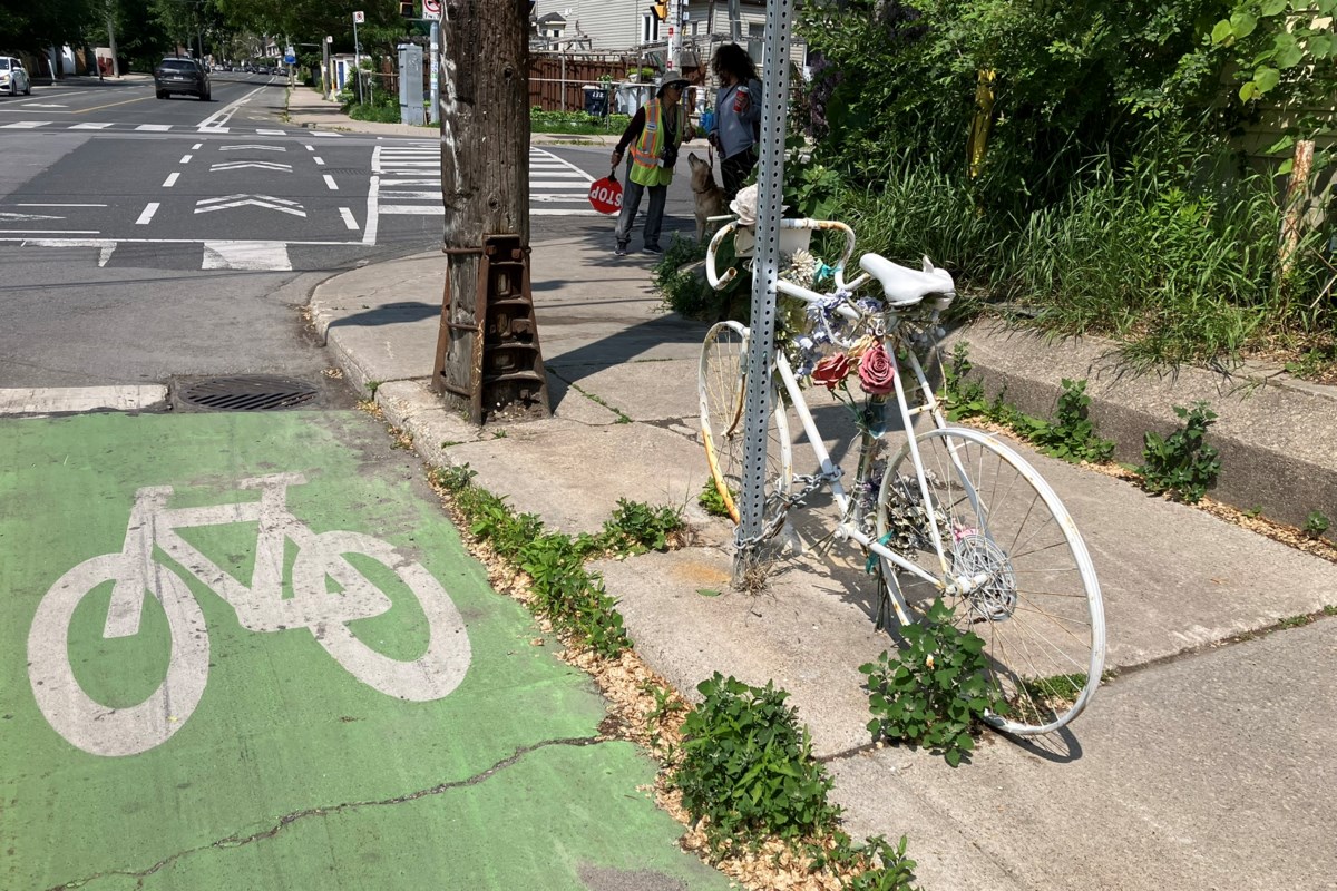
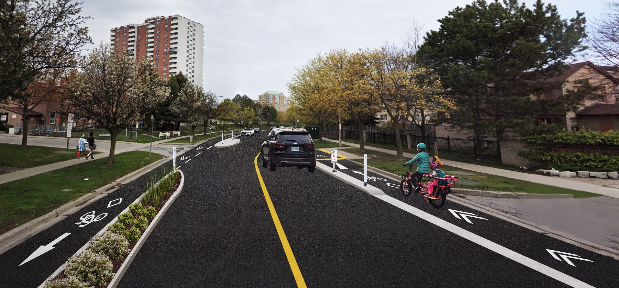
News   GLOBAL  |  Apr 02, 2020
 10K     0 
News   GLOBAL  |  Apr 01, 2020
 42K     0 
News   GLOBAL  |  Apr 01, 2020
 5.9K     0 

It's a small thing but it bothers me that the city's graphic here shows various "recommended cycling streets" with zero actual infrastructure as part of the solid lined "existing cycling network." This includes Old Park, which runs north of Eglinton in Upper Village, and Elm Ridge, which runs E-W just above the Belt Line. Those streets are often congested with impatient SUVs trying to get to Eglinton or the Allen, and there is nowhere safe for a cyclist to ride. Even Lascelles just west of Yonge, while a fine quiet street to ride on and part of the city's now defunct numbered cycling routes, has no bike lanes.

It all feels like puffing up the very poor and disjointed network. It's misleading and outdated, at best. Those streets are useful suggestions given the lack of real cycling infra, but they aren't a cycling network.
While I agree that the City could make their maps clearer to show how much (if any) 'cycling infrastructure' is on a street it is unreasonable to expect a fully integrated network of good cycling routes to be feasible 'over night" (or over several decades!) The network is being built incrementally as it is done with limited funds, while other road work is happening or ......
 
I am not sure where I asked for anything to be built overnight. My point was only about representing streets with no infrastructure as a "cycling network." We are hemming & hawing, pausing or stopping planned work, while other cities leapfrog us. Look at Eglinton: That project has been over a decade in the works. It was meant to be done last year, and that was stalled to this year. Now we are getting more pieces taken out. A bike route with a missing middle is not a bike route. Elected officials (and yes, staff) are more prone than ever to kowtowing to community pushback, and the pushback has become more organized and savvy. See the instagram pages and websites built by these astroturfing groups like "Balance on Bloor" or "ABC Toronto." To me these efforts are obviously phony and lacking in any facts or data, but they seem to stoke fear in councillors. Meanwhile, by claiming a "cycling network" built of non-laned side streets, the city can dodge pressure to actually build lanes. So going back to the map: this matters!
 
How about a compromise and just paving the section of the Beltline from Bathurst to the point where the trail passes under the Eglinton bridge? It's highly used, there's a high school and residential density, there will be a crosstown station connection, and it's the section with the poorest quality of trail.

But it truly is so sad, the lack of progress of better infrastructure around Little Jamaica. I think Councillor Colle is a making a really big mistake by pausing the construction. With the Crosstown opening it's a chance to pivot from car-centricity to really build a section of the city for people but it seems he's listening to the people east of the Allen who just want to get around quickly in their cars without getting stuck in traffic.
 
One more public consultation for cyclists in Scarborough. This time for the Malvern Neighbourhood Connections.

You can attend the public drop-in event on Tuesday, June 24 (7:00-8:30 PM) at St. Columba Catholic School (10 John Tabor Trail) or complete the survey by Tuesday, July 8.

 
One more public consultation for cyclists in Scarborough. This time for the Malvern Neighbourhood Connections.

You can attend the public drop-in event on Tuesday, June 24 (7:00-8:30 PM) at St. Columba Catholic School (10 John Tabor Trail) or complete the survey by Tuesday, July 8.


That's a modest, but really solid package. The effect is somewhat limited to the immediate community but it should definitely improved safety and encourage walking and biking.
 
That's a modest, but really solid package. The effect is somewhat limited to the immediate community but it should definitely improved safety and encourage walking and biking.
Well, NL, you weren't kidding when you mentioned there were a lot of consultations coming down the pipe. ;)
 
It's a small thing but it bothers me that the city's graphic here shows various "recommended cycling streets" with zero actual infrastructure as part of the solid lined "existing cycling network." This includes Old Park, which runs north of Eglinton in Upper Village, and Elm Ridge, which runs E-W just above the Belt Line. Those streets are often congested with impatient SUVs trying to get to Eglinton or the Allen, and there is nowhere safe for a cyclist to ride. Even Lascelles just west of Yonge, while a fine quiet street to ride on and part of the city's now defunct numbered cycling routes, has no bike lanes.

It all feels like puffing up the very poor and disjointed network. It's misleading and outdated, at best. Those streets are useful suggestions given the lack of real cycling infra, but they aren't a cycling network.
What bothers me even more is that information about bicycle path/trail/lane closures is very difficult to find. The city has an official map of cycling routes at
How difficult would it be to add to it information about closures? Next to it there is another page with a map of road closures, but it only shows road closures of course. With half a dozen Toronto strategies, visions and plans for bicycling and frequent public pronouncements, you would think helping people plan how to get from A to B on bicycle would be in somebody's job description.
 
What a fumble...


Some excerpts:

City staff initially estimated the upgrade to a cycle track would require the removal of 30 of the 78 parking spots on the street, due to constraints with road width.

But according to Jacquelyn Hayward, director of transportation planning at the City of Toronto, staff underestimated the actual loss of parking needed, meaning city council approved a plan “quite different from what was possible.”

Instead of 30 lost parking spaces, the plan would actually require the removal of 48 spots.

The miscalculation arose because city staff didn’t take into consideration the loss of parking required near intersections, where tapers would be installed to help control traffic flow.

Hayward called the loss of an additional 18 parking spaces “significant” because permit parking in the area is highly utilized. In 2023, 58 parking permits were issued for the 78 parking spots on the street, according to a city report.

That’s why city staff are now recommending councillors rescind approval of the cycle track upgrade and proceed with a plan to maintain the painted bike lane with some additional safety features.

Meanwhile, 35 per cent of respondents were against maintaining the painted bike lane because they felt it didn’t provide adequate protection for cyclists. Overall, 63 per cent of those polled said they did not feel safe cycling on Jones Avenue.
Could they try asking the 58 permit holders to give their number for what it would take as a cash payout to forego their permit? See what number the 18th person provided and give all those people that amount. On the scale of what we spend on infrastructure projects, even if it was $10k per permit, that would not be an undue fiscal burden.
 
What a fumble...


Some excerpts:

City staff initially estimated the upgrade to a cycle track would require the removal of 30 of the 78 parking spots on the street, due to constraints with road width.

But according to Jacquelyn Hayward, director of transportation planning at the City of Toronto, staff underestimated the actual loss of parking needed, meaning city council approved a plan “quite different from what was possible.”

Instead of 30 lost parking spaces, the plan would actually require the removal of 48 spots.

The miscalculation arose because city staff didn’t take into consideration the loss of parking required near intersections, where tapers would be installed to help control traffic flow.

Hayward called the loss of an additional 18 parking spaces “significant” because permit parking in the area is highly utilized. In 2023, 58 parking permits were issued for the 78 parking spots on the street, according to a city report.

That’s why city staff are now recommending councillors rescind approval of the cycle track upgrade and proceed with a plan to maintain the painted bike lane with some additional safety features.

Meanwhile, 35 per cent of respondents were against maintaining the painted bike lane because they felt it didn’t provide adequate protection for cyclists. Overall, 63 per cent of those polled said they did not feel safe cycling on Jones Avenue.
That is outrageous. The existing door zone "cycling lane" is very dangerous and removing the parking on one side of the street to create a cycle track is the only serious way to fix the problem. Rebuilding this as-is to cycling standards of 1998 would be stupid.
 
What a fumble...


Some excerpts:

City staff initially estimated the upgrade to a cycle track would require the removal of 30 of the 78 parking spots on the street, due to constraints with road width.

But according to Jacquelyn Hayward, director of transportation planning at the City of Toronto, staff underestimated the actual loss of parking needed, meaning city council approved a plan “quite different from what was possible.”

Instead of 30 lost parking spaces, the plan would actually require the removal of 48 spots.

The miscalculation arose because city staff didn’t take into consideration the loss of parking required near intersections, where tapers would be installed to help control traffic flow.

Hayward called the loss of an additional 18 parking spaces “significant” because permit parking in the area is highly utilized. In 2023, 58 parking permits were issued for the 78 parking spots on the street, according to a city report.

That’s why city staff are now recommending councillors rescind approval of the cycle track upgrade and proceed with a plan to maintain the painted bike lane with some additional safety features.

Meanwhile, 35 per cent of respondents were against maintaining the painted bike lane because they felt it didn’t provide adequate protection for cyclists. Overall, 63 per cent of those polled said they did not feel safe cycling on Jones Avenue.

On the initial miscalculation.............mistakes happen. Not an excuse, shouldn't have happened, but when things like this go in for approval-in-principle they haven't yet gone through schematic design or working drawings.

While it would have been nice if staff had a more accurate picture of things initially, its equally likely with Councillor Fletcher that she would have just spiked the thing at that earlier point.

The problem here is not tackling the radical under-pricing of parking permits.

The cost of the permit the majority of people get (no parking on site where you live) is $23 per month.

But at Queen/Jones, if you went to rent a monthly spot on the private market, you wouldn't find one cheaper than $120.

Even a second parking permit for the same household is only $67 per month; while some a household with on-site parking pays $93.

How about, the entry level permit is $110, and the other two class of permits are merged at $140?

IF you do that, demand will drop, lot of spaces will be empty.

If you also transfer the windfall to the TTC to be used for better service/lower fares........even more spots empty out.

The Jones bus is every 13M in rush hour, and every 22M off-peak.

You want people on Jones to stop owning so many cars........?

Rush hour service every 10M or better, off-peak every 15M or better is the minimum requirement.
 

Attachments

  • 1749839590078.png
    1749839590078.png
    553.5 KB · Views: 31
Last edited:
I wanted an easy way to check the overall progress of Toronto's 2025-2027 cycling program and the expected start dates of each one, so I made a summary table in google sheets (preview below). I matched each project name/status category with the expected construction timeline from TOINview, and used various sources to verify their actual progress (i.e. this thread, Toronto Cycling twitter... rest in the spreadsheet). There's quite a few projects listed as underway when the table was published (July 2024) that I haven't found anything on. Two Wheeled Politics also keeps a very in-depth table of completed projects but not the same info on the current program. Happy to make anyone an editor if they are interested, I will also periodically update it

1749939203425.png
 
I wanted an easy way to check the overall progress of Toronto's 2025-2027 cycling program and the expected start dates of each one, so I made a summary table in google sheets (preview below). I matched each project name/status category with the expected construction timeline from TOINview, and used various sources to verify their actual progress (i.e. this thread, Toronto Cycling twitter... rest in the spreadsheet). There's quite a few projects listed as underway when the table was published (July 2024) that I haven't found anything on. Two Wheeled Politics also keeps a very in-depth table of completed projects but not the same info on the current program. Happy to make anyone an editor if they are interested, I will also periodically update it

View attachment 658844
For the first time for several years I cycled down the Rosedale Valley Road trail today. It is a bit better than it used to be but I seem to remember there were (and still are??) plans to make it better and if nothing else it needs more paving work!
 

Back
Top