


TwoWheelPoli
Active Member
Don Mills south of Gateway.Sorry, I am confused where this is. What would be the nearest street intersection?
|
|
|
Don Mills south of Gateway.Sorry, I am confused where this is. What would be the nearest street intersection?
I went down the trail south of Pottery Road which is now open until just north of Riverdale Park, but of course there are no exits here so you have to turn back and return to Pottery. It won't be a useful route for cyclists until this work is done, or at least the Riverdale bridge portion is reopened.Not sure if anyone posted this update from City website. I will believe it opens when I can walk/bike on it.
View attachment 664078
Yes, a child of 5 would have noticed that the river banks were being washed away and thus that building ramps and wider paths would be 'challenging'. It IS clearly moving on towards completion but after 3+ years (or is it 4+ ??_) it damned well should be.I went down the trail south of Pottery Road which is now open until just north of Riverdale Park, but of course there are no exits here so you have to turn back and return to Pottery. It won't be a useful route for cyclists until this work is done, or at least the Riverdale bridge portion is reopened.
I am so tired of excuses the city cites for this years-delayed project. As if they didn't know the soil was poor, or the work area was narrow or they would be next to Metrolinx tracks. I'm sure Metrolinx is a pain in the ass to work with, but who is not planning for that in this city?
On the bright side, I saw some nice new seating and art to the side of the trail below Pottery Road, still fenced off, but maybe it will open some day.
View attachment 664161 View attachment 664162
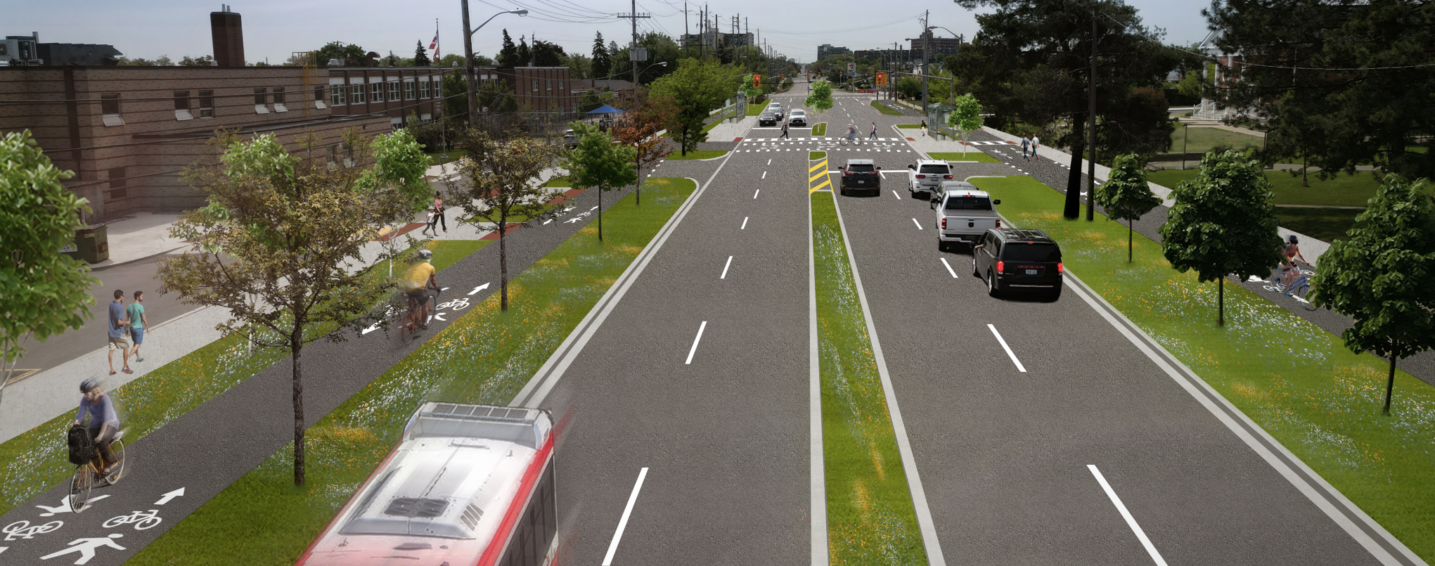
Are there maybe plans for cycling infrastructure on St. Clair East?
***
Anyone know anything about such plans?
 yoursay.mississauga.ca
Yup, its in the Bike Plan.
But given that it probably means removing traffic lanes.........
(The centre lane provides some space, but not enough; There's only ~15M of width curb to curb and you require at least 12M to keep 4 vehicle lanes, but 15m at intersections with a left hand turn lane.)
****
FWIW, the work is currently penciled in for 2027, but I would take that with a very large grain of salt.
 .
.Has it been "approved" by Mayor of all the Ontario cities' Doug Ford? Noticed many of the routes are shared with motor vehicles on the arterial roads.Final Report isn't yet done, but this page reflects an update to the Mississauga Cycling Masterplan:
Implementing the Cycling Master Plan
I'm only going to lift one slide (divided into two for enlargement)
This is the 5-year plan (pink), and the priority routes (blue outline)
View attachment 664542
View attachment 664543
There are some good things here, but I kind of think the plan for Port Credit needs work. The new Port Credit river crossing south of the tracks will be great for taking traffic off Lakeshore/Hurontario if built, but I've had bad experiences at Mississauga Road where it passes under the tracks. There's supposed to be a new crosswalk installed when the Credit River bridge is built, but (EDIT: no traffic lights are planned, just a flashing yellow 'warning beacon'). The rail bridge limits visibility, and people drive very fast down Mississauga Road. The section south of there to Lakeshore should be part of the 5-year plan to connect with the new cycle track & condo developments south of Lakeshore.Final Report isn't yet done, but this page reflects an update to the Mississauga Cycling Masterplan:
Implementing the Cycling Master Plan
I'm only going to lift one slide (divided into two for enlargement)
This is the 5-year plan (pink), and the priority routes (blue outline)
View attachment 664542
View attachment 664543
I saw "Trail Closed" signs just north of the Don Mills underpass last week, but no notice of construction, nor for how long. Things like this need to be much better communicated! And they (the city) needs to realize that the park trails is important for regular commuters, so the length of disruption needs to be minimized. Gah!View attachment 664905View attachment 664906
New signs up for the lower don trail construction south of gateway and don mills. I spoke to a worker who confirmed it is to replace the staircase with a gradual slope, but they also said it will be a 4 way junction. There are currently only 3 trails meeting here so maybe it’s to connect to the east don trail in the future

 www.thestar.com
 www.toronto.ca