News   GLOBAL  |  Apr 02, 2020
 11K     0 
News   GLOBAL  |  Apr 01, 2020
 43K     0 
News   GLOBAL  |  Apr 01, 2020
 6.9K     0 

TwoWheelPoli

Active Member
Member Bio
Joined
Apr 17, 2025
Messages
500
Reaction score
1,995
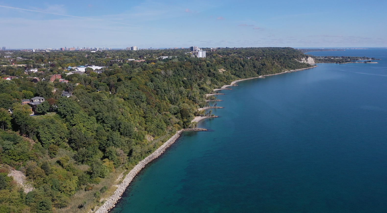
To distinguish from the Scarborough Waterfront Project which covers the Scarborough Bluffs to East Point Park, here's a new thread focused on the Scarborough Bluffs West Project from Balmy Beach to the Scarborough Bluffs.

The third round of public consultations - and the first since the environmental assessment was launched - will be held on Monday, June 1 (5:30 - 8:30 PM) at Birchmount Park Collegiate Institute (3663 Danforth Avenue).

The public consultation materials will become available on Tuesday, May 26 at the website linked below and the survey will be open from then until Tuesday, June 30. The public consultation notice can be found below.


14024.jpg

14028.jpg
 
The consultation materials are now up on the project website. A bit awkward to navigate given multiple PDF's were used, but the options basically fall into three categories.

1. Do Nothing
2. Shoreline Alternative
3. Tableland Alternative

The project is also broken down into the following segments:

1A. Silver Birch to east of RC Harris Water Treatment Plant
1B. RC Harris Water Treatment Plant to Warden
2. Warden to Birchmount
3. Birchmount to Midland
4. Midland to Bluffers Park

Personally, I would prefer the shoreline options (whenever possible) as they would offer the most direct route. The tableland option basically keeps a similar route as before, but adds on-street cycling infrastructure and upgrades some trails.
 
TY, I think, to @TwoWheelPoli for the post above.

SMH.....

OMG..

If I don't sit on every damn committee.........

I only have so much time people..................wow there are problems here......

****

I'm not going to dissect everything publicly, for now, because I need to try to fix this mess.............

We need to separate the idea that any up-top route is an alternative to an at-the-shoreline route.

As a start.

They are two completely different ideas, and you can pursue one, the other, or both...........but one is not a substitute for the other.

Second, that top line route assumes no acquisition of private property as best I can tell, that's dumb.

We may not realistically be able to acquire everything that is bluff-top in the near term, though since all of it will fall over said bluff in the next 200 years.....owners should have an incentive to entertain reasonable offers.

The top-of, proposal is not realistic or desirable to anyone.

The bottom/shoreline is more complicated.

I'm getting a headache.

Ok, I have to stop there, because it would interfere with ability to mess w/this. Damn it..........

You have a top route and a bottom route and they both suck.
 
This is not a very clear presentation by the city. Even @TwoWheelPoli 's photos (which are excellent) don't really make clear that 3 of the 5 segments have multiple shoreline options, in addition to the tableland and do nothing options. For brevity, I'll just post the shoreline options, which I've re-numbered for clarity.

1A. Silver Birch to east of RC Harris Water Treatment Plant

The only Shoreline option for this segment:
Screenshot 2026-06-04 at 12.26.04 AM.png

1B. RC Harris Water Treatment Plant to Warden
Here, there are 3 shoreline options.
Shoreline 1. Groynes
Screenshot 2026-06-04 at 12.07.32 AM.png


Shoreline 2. Elevated Boardwalk
Screenshot 2026-06-04 at 12.07.58 AM.png


Shoreline 3. Islands
Screenshot 2026-06-04 at 12.14.02 AM.png

2. Warden to Birchmount
The only shoreline option:
Screenshot 2026-06-04 at 12.30.47 AM.png

3. Birchmount to Midland
Here, there are 3 shoreline options.
Shoreline 1. Groynes
Screenshot 2026-06-04 at 12.17.37 AM.png


Shoreline 2. Elevated Boardwalk
Screenshot 2026-06-04 at 12.17.53 AM.png


Shoreline 3. Islands
Screenshot 2026-06-04 at 12.18.07 AM.png

4. Midland to Bluffers Park
Here there are 2 shoreline options.
Shoreline 1. Bridge alignment #1
Screenshot 2026-06-04 at 12.21.42 AM.png


Shoreline 2. Bridge alignment #2
Screenshot 2026-06-04 at 12.23.27 AM.png
 
Last edited:
And now the tableland (cliff top) options. Most of this seems to be on-street. For those on-street portions, other than a bike lane (painted?) and the removal of street parking, I don't see much difference from what exists now.
1A. Silver Birch to east of RC Harris Water Treatment Plant
Screenshot 2026-06-04 at 1.24.14 AM.png

1B. RC Harris Water Treatment Plant to Warden

Screenshot 2026-06-04 at 1.19.16 AM.png

2. Warden to Birchmount

Screenshot 2026-06-04 at 1.21.54 AM.png

3. Birchmount to Midland

Screenshot 2026-06-04 at 12.59.10 AM.png


4. Midland to Bluffers Park
Screenshot 2026-06-04 at 12.58.14 AM.png
 
And now the tableland (cliff top) options. Most of this seems to be on-street. For those on-street portions, other than a bike lane (painted?) and the removal of street parking, I don't see much difference from what exists now.

View attachment 741507


View attachment 741504


View attachment 741505


View attachment 741500


View attachment 741502
Thanks. Felt showing every slide on my blog would not have been practical.

I know the tableland route has some variation from the current route, but still prefer the shoreline option as much as possible.
 

Back
Top